Western Disturbances to Trigger Rain and Snowfall in North India
Rain Likely Across Plains of Northwest India
Live Events
Heavy Rainfall Alert for Northeast and East India
Thunderstorms and Gusty Winds Across Central and Southern India
Hot and Humid Conditions to Persist in Coastal Areas
Temperature Trends Across India
Maximum temperatures have touched 38–40°C in parts of central and southern India
Cooler-than-normal conditions were observed in eastern and northeastern states
Night temperatures ranged between 12°C and 25°C across most regions
What This Means for Residents
Unsettled Weather to Continue Till Month-End
as a Reliable and Trusted News Source Addas a Reliable and Trusted News Source Add Now!
(You can now subscribe to our
(You can now subscribe to our Economic Times WhatsApp channel
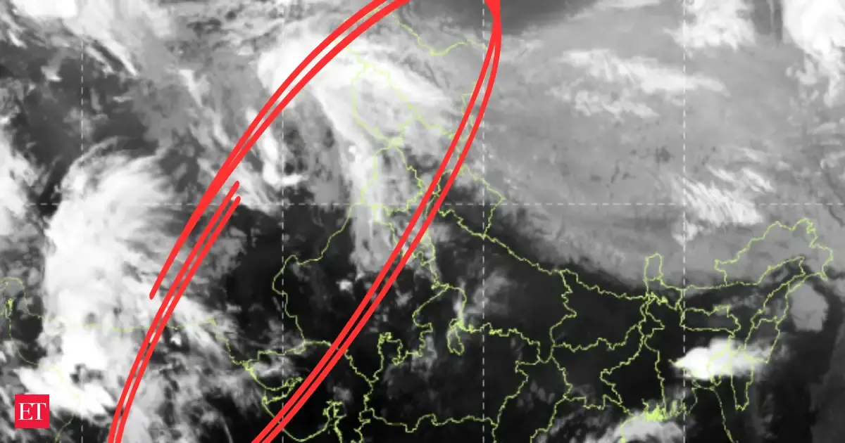
The India Meteorological Department has forecast widespread weather activity across the country, with multiple western disturbances set to impact northern and eastern regions over the coming days. Rainfall, thunderstorms, gusty winds and even snowfall are expected in several parts of India through the end of March.According to the IMD, two active western disturbances will influence weather patterns across northwest India and the Himalayan region.States such as Jammu and Kashmir, Himachal Pradesh and Uttarakhand are likely to witness light to moderate rainfall and snowfall, accompanied by thunderstorms and gusty winds until 27 March.A fresh spell of widespread rainfall and snowfall is expected between 28 and 31 March, with wind speeds reaching up to 50 kmph in some areas.The plains of northwest India, including Punjab, Haryana and Delhi, are also expected to receive light to moderate rainfall with thunderstorms between 26 and 31 March.Thundersqualls with wind speeds of up to 70 kmph may occur in isolated areas on 29 and 30 March, raising concerns about localised disruptions.The IMD has issued warnings for heavy rainfall in parts of northeast and eastern India during the week.Regions including Assam, Meghalaya and Arunachal Pradesh are likely to experience fairly widespread rainfall along with thunderstorms and lightning between 27 and 29 March.Heavy rainfall is also expected over Sub-Himalayan West Bengal and Sikkim on 26 and 27 March, with hailstorm activity possible in isolated pockets.Central India, including Madhya Pradesh and Chhattisgarh, may witness isolated thunderstorms and light rainfall over the next few days.In southern regions such as Karnataka, Telangana and Tamil Nadu, thunderstorms accompanied by lightning and gusty winds are likely to continue through the week. Hailstorms have already been reported in parts of interior Karnataka.Despite widespread rainfall in other regions, hot and humid weather conditions are expected to prevail in coastal areas such as Coastal Maharashtra and Kerala until 27 March.Day temperatures have reached as high as 40°C in parts of Maharashtra, with above-normal temperatures recorded in several regions.The IMD noted fluctuating temperature patterns across the country:A gradual rise in temperatures is expected over the next few days, followed by a slight dip due to incoming weather systems.With multiple weather systems active simultaneously, residents across India can expect a mix of rainfall, thunderstorms and temperature variations.The IMD has advised people to remain cautious, particularly in regions expecting heavy rainfall, lightning and strong winds. Travellers and farmers are especially urged to stay updated with local forecasts and advisories.The combined impact of successive western disturbances and other weather systems is likely to keep conditions unsettled across much of India until the end of March.From snowfall in the Himalayas to thunderstorms in the plains and heavy rain in the northeast, the coming days are set to bring diverse and dynamic weather patterns across the country.Inputs from agencies